Illegal small-scale mining locally known as galamsey has become a national crisis in Ghana. Rivers such as the Pra, Ankobra, and Birim, once clear sources of drinking water, now run brown with silt and mercury. Satellite data indicate that Ghana lost about 35,000 hectares of forest cover in 2024, with nearly a third of that loss occurring along waterways as a direct result of illegal mining. More than one million people are involved in artisanal and small-scale gold mining, and roughly 30% of them operate outside the law.
The environmental and water-treatment liabilities of this sector are estimated at GH¢17.7 billion per year¹ a staggering bill borne largely by the state and the communities living downstream from abandoned pits. Traditional enforcement, relying on human patrols and sporadic raids, routinely arrives after sites have been stripped and equipment moved. This reactive approach is not only costly; it is dangerous. Attacks on anti-galamsey personnel and journalists have surged, with 10 of 16 documented attacks since 2017 occurring in 2025 alone, and in May 2017 soldier Captain Maxwell Mahama was lynched while on duty.
This article the first of two parts explores why Ghana’s fight against illegal mining needs a technological revolution. It examines the scale and consequences of galamsey and makes the case for a robust, technology-driven system that combines satellites, artificial intelligence (AI), drones, and real-time alerts. Part 2 will set out how such a system should be designed, its key advantages, and the challenges that must be overcome.
1. The Scale and Impact of Galamsey
1.1 Environmental Degradation
Illegal mining devastates ecosystems at a pace that outstrips the state’s capacity to respond. Water analyses show that turbidity in the Pra and other rivers has reached 12,000–14,000 NTU seven times the Ghana Water Company’s plant design limit. Mercury concentrations exceed World Health Organisation limits by sixfold in some rivers, wiping out aquatic life, contaminating farmland, and exposing communities to neurological hazards.
Forests are being ravaged in tandem: 35,000 hectares (ha) of forest were lost in 2024, with roughly a third of that attributable to illegal mining along waterways. Deforestation exposes soils, accelerates erosion, and reduces biodiversity. The Atewa forest home to critically endangered species and a source of drinking water for millions has been scarred by excavators. Once lost, these ecosystems take decades to recover, if they recover at all.
1.2 Socioeconomic Costs
Ghana’s Minerals Commission estimates that more than 1 million people derive income from artisanal and small-scale mining, with approximately 30% operating illegally. While the sector provides livelihoods and accounts for nearly 40% of the country’s gold output, it imposes enormous hidden costs on the broader economy.
Water treatment expenses and environmental liabilities are projected to reach GH¢17.7 billion by 2030. The World Bank projects that degraded watersheds could reduce Ghana’s agricultural productivity by 6% by 2030, and the Ghana Statistical Service attributes 5–7% of GDP losses in affected districts to land degradation and pollution. Food security is under particular strain: cocoa yields in affected mining areas have plummeted by up to 40%, while maize and cassava production have fallen by 60% and 45% respectively. For a country that stakes its international reputation on being the world’s second-largest cocoa producer, this is not merely an environmental issue it is an existential economic threat.
1.3 Human Toll and Security Risks
The human cost of galamsey is equally alarming. A timeline compiled by Finex Insights documents 16 attacks on anti-galamsey taskforces and journalists between 2017 and 2025, with 10 attacks occurring in 2025 alone. The incidents span years and regions: in May 2017, Captain Mahama was lynched while on duty; in August 2023, a forestry officer was shot during a patrol; and clashes in January 2025 at the AngloGold Ashanti site in Obuasi led to the deaths of about seven miners.
Such incidents reveal the dangers of relying solely on human patrols in remote, often hostile terrain. They highlight an urgent need for technology to reduce direct confrontation, improve situational awareness, and protect both enforcement officers and the communities they serve.
2. Why Satellites and AI?
2.1 Continuous, Wide-Area Coverage
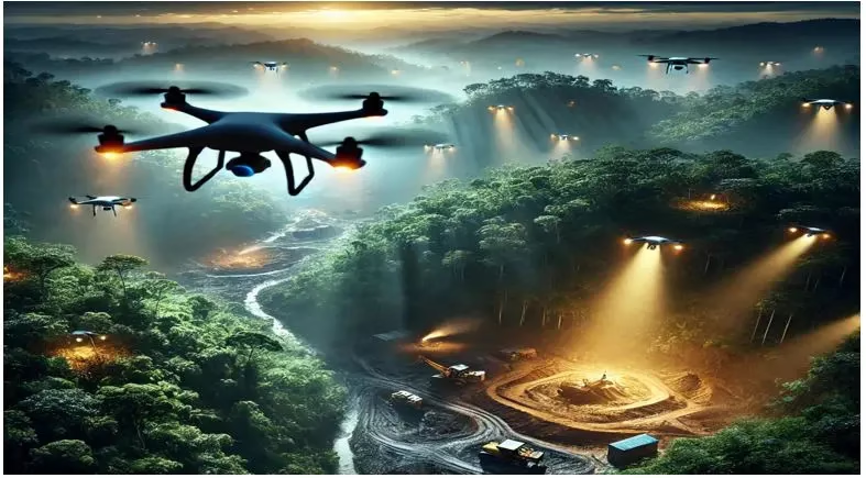
Modern satellite constellations offer something that human patrol teams simply cannot: continuous, comprehensive coverage of Ghana’s forested regions. Sentinel-1 satellites use C-band synthetic aperture radar (SAR), enabling detection of ground disturbance even through cloud cover a critical capability in a country where heavy cloud prevents optical imaging for months at a time. Platforms such as Google Earth Engine host massive archives of satellite data and provide tools for land-cover classification and change detection.
Combined with cloud computing, these systems can process new imagery rapidly and generate near-real-time alerts. Global Forest Watch and similar platforms integrate radar-based alerts to highlight areas of likely forest disturbance within days of the event, giving authorities a significant head start over traditional inspection schedules.
2.2 Automated Detection with AI
AI gives meaning to the data captured by satellites and drones. Machine learning models trained on thousands of aerial images can automatically detect changes in terrain colour, water turbidity, and pit geometry. Algorithms classify imagery into legal, suspended, or illegal mining zones and trigger alerts when anomalies occur.
Deep learning models such as VitSegh24 built on SegFormer, a vision transformer architecture can segment features like waste-rock dumps, open pits, water ponds, and tailings dams from high-resolution Sentinel-2 imagery covering Ghana’s mining regions. The model’s dataset includes 188 tiles of Sentinel-2 imagery covering more than 1,003 km², and labels a wide variety of mining footprints, enabling automated, near-continuous mapping of extraction sites across vast stretches of forest and farmland.
2.3 Faster Response and Predictive Governance
Integrating AI and remote sensing shifts governance from reactive to predictive. Instead of waiting for environmental damage to be reported after the fact, authorities can anticipate and intervene before rivers turn brown or forests vanish.
Ghana’s National Mine Surveillance Centre, launched in 2023, provides a compelling proof of concept. Over 120 drones deployed across mining corridors feed imagery to the centre, where AI has improved illegal site detection accuracy from 58% in 2022 to 92% in 2025 cutting response times from five days to less than twelve hours. The system reportedly prevented ₵400 million in potential gold-smuggling losses. Such improvements allow enforcement personnel to focus on the highest-risk sites and reduce the scale, cost, and danger of large patrol convoys.
Looking Ahead
The evidence is clear: Ghana is losing the fight against galamsey through conventional means alone. The environmental damage is accelerating, the economic costs are mounting, and the human toll is rising. But the data also point towards a solution. Part 2 of this series sets out how an integrated satellite-AI monitoring framework can be designed and deployed and confronts the funding, capacity, and governance challenges that stand between Ghana and a technology-driven path to cleaner rivers and safer forests.
Sources
¹ Ghana Water Company Ltd. projects that the cumulative cost of treating galamsey-contaminated water could reach GH¢17.7 billion by 2030, driven by deteriorating raw-water quality across more than 18 major rivers. Source: Adomonline.com / MyJoyOnline.com, “Explainer: Why treating water could cost Ghana Water Ltd. ¢17.7 billion by 2030,” October 2025.
² Global Forest Watch / Hansen/UMD/Google/USGS/NASA Tree Cover Loss dataset, 2024 annual update.
³ Finex Insights, “Violence Against Anti-Galamsey Taskforces and Journalists, 2017–2025,” compiled March 2025.
⁴ Ghana Minerals Commission, Artisanal and Small-Scale Mining Sector Report, 2024.
⁵ Atakora, R. et al., “VitSegh24: Vision-Transformer Segmentation of Mining Footprints from Sentinel-2 Imagery,” Remote Sensing Letters, 2024.
Author
Joseph Borketey | AI Automation | Agentic AI |Member, IIPGH
For comments, call +44 7984754579 or email joe.bornrich@outlook.com